walking the Glenlyon Biolink (Under Construction)
About the Biolink
Biolinks are wildlife and pollinator corridors. They connect pockets of native vegetation allowing animals to move between these areas and increase the genetic diversity in breeding populations, and areas where pollinator species can flourish providing insect bridges to urban areas. When developed along river banks they can contribute to the health and wellbeing of the waterway.
They also provide attractive walkways for the community and visitors.
Work on creating the Glenlyon Biolink commenced in 2004 with the clearing of a heavy infestation of blackberry, gorse, and broom from the area south of the Daylesford-Malmsbury Road bridge over the Loddon River .
Station 1
Welcome to the Biolink
At Station 1 you are looking at the site of the flour mill and water wheel pit. The mill ran from 1873 until 1886. It's closure was due to the statewide drought which lasted from 1880 until 1886, resulting in lack of water and crop failures.
Station 2
Station 2
Welcome to the Biolink
At Station 2 you are looking at the site of a former river crossing. There are still a few cobblestones visible. This was the only way to cross the Loddon River before the first bridge was built in 1864. The track came down the hill beside the present main road, along the bottom and wound up to Loddon Drive.
Station 3
Station 3
Station 2
Welcome to the Biolink
At Station 3 you are looking at the site of a pine plantation planted by Glenlyon school pupils circa 1956, with the purpose of selling the mature timber to earn money for the school.
Station 4
Station 3
Station 4
Welcome to the Biolink
At Station 4 you are looking at the remains of a weir built by Jack and George (Curly) Dixon to irrigate their potato patch circa 1950s. George Dixon was a WW1 veteran.
Above the weir is a former bluestone quarry (Quarry Reserve)
Station 5
Station 3
Station 4

Welcome to the Biolink
At Station 5 you are looking at the site of a gravel pit owned by the Fleischer family. The Shire Council used the gravel for road metal, and local women collected pipe clay to whitewash their fireplaces.
Ian Fleischer collected the clay to whitewash the Glenlyon Hall fireplaces.
Station 6
Station 6
Station 6

Welcome to the Biolink
At Station 6 you are looking at a gate up the hill that marks a former entrance to the Glenlyon Recreation Reserve.
It is proposed to restore the track and reopen the entrance.
Station 7
Station 6
Station 6
Welcome to the Biolink
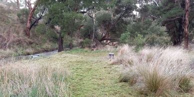
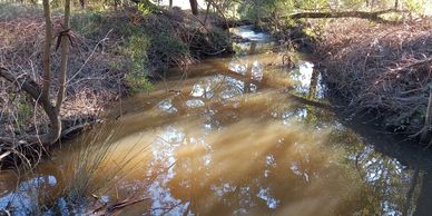
At Station 7 you are looking at where the river has changed course many times due to flooding, fallen trees, debris, etc.
Traces of the old course are still visible
Station 8
Station 6
Station 8
Welcome to the Biolink
At Station 8 you are looking at ...
Traces of the old course are still visible
Station 9
Station 10
Station 8
Welcome to the Biolink
At Station 9 you are looking at ...
Station 10
Station 10
Station 10
Welcome to the Biolink
At Station 10 you are looking at ...
Station 11
Station 10
Station 10
Welcome to the Biolink
At Station 11 you are looking at ...